

Living on South Vancouver Island
A Capital City at One End, Farm and Lake Country at the OtherLiving on South Vancouver Island means choosing between a capital city, its seaside suburbs, the farmland and lakes of the Cowichan Valley, and the coastline in between, and the drive over the Malahat is what separates them.

Living in South Vancouver Island brings together harbour cities, seaside neighbourhoods, commuter convenience and a lifestyle shaped by the mildest climate on the Island.
- Greater Victoria is the most urban part of Vancouver Island. It also carries the largest transit system on the Island by a wide margin2.
- North of the Malahat is where land is easier to find. Acreage, farm property and lakefront are far more common in the Cowichan Valley than south of the pass.
- Highway 1 over the Malahat is the main direct connection. The Mill Bay to Brentwood Bay ferry crosses Saanich Inlet when it is operating3.
- Swartz Bay is the southern mainland terminal. It also carries the Gulf Islands sailings, and Victoria International Airport is beside it3.
- The Cowichan Valley records some of the warmest annual averages in Canada. It sits inside the east coast rain shadow4.
- Health care is concentrated in Greater Victoria. Three hospitals there, and one 24 hour emergency department in the valley1.
Five Places, Not One Region
The south end holds the Island's largest concentration of jobs, services and transit at one end, and farm, forest and lakefront country at the other. Highway 1 over the Malahat runs between them. Where you land inside that spread changes the commute, the housing you can buy and how much of everyday life happens close to home.
When the South End Suits You
- Walkable streets, frequent transit and a short trip to most services matter more than lot size.
- Work is in government, education, health care, the military, technology or a service economy.
- Land, a lake or a working acreage is the point, and a longer drive for services is acceptable.
- A mild climate and a long growing season are worth paying for.
- Both halves are worth comparing rather than one being ruled out before the search starts.
When It Works Against You
- The budget is tight against South Island prices, which sit above most of Vancouver Island.
- A daily Malahat commute is planned and has not yet been driven in winter conditions.
- Rural land inside Greater Victoria is the requirement, and there is very little of it.
- Frequent trips to the rest of Vancouver Island are expected, since everything else is further from here.
- Regular specialist appointments are part of life and the property being considered is well north of the pass.
Both lists point at the same crossing. Work out which side you belong on and the rest of the decision gets much smaller.
What Changes as You Move North
Greater Victoria is bounded by water on three sides and by the Agricultural Land Reserve inland, which limits how much new ground there is to build on. That constraint is a large part of why property there prices differently from the rest of Vancouver Island.
North of the Malahat there is simply more land. Lot sizes grow, acreage and farm property become ordinary rather than exceptional, and the range of what a given budget can buy widens considerably. What comes with that is distance, and for anyone working in the capital region it comes with the pass.
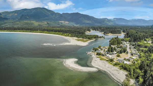
City and Valley, the Best of Both Ends
Where to Look First
Five areas, and Highway 1 runs through the middle of them. Open the one that fits how you want to live, then compare the communities inside it.
Greater Victoria
Victoria, Oak Bay, Esquimalt, Saanich, View Royal, Central Saanich, North Saanich and Sidney. The Island's deepest job market, its largest transit system and its most walkable neighbourhoods. Housing runs from character homes to condos and townhomes, and this is where the Island's highest prices sit.
The Westshore and Sooke
Colwood, Langford, Highlands, Metchosin, Sooke, East Sooke, Otter Point, Jordan River and Port Renfrew. Newer housing, more of it, and generally more square footage for the money, paid for in commute. Past Sooke the coastline gets steadily more remote and the drive into town stops being routine.
The Cowichan Valley
Duncan, East and West Duncan, Cobble Hill, Mill Bay, Shawnigan Lake, Cowichan Bay, Cowichan Station, Glenora and the Malahat. Farm country, vineyards and a genuine agricultural economy, with Duncan as the commercial centre. Acreage, hobby farms and larger lots are ordinary here in a way they are not further south.
The Cowichan Coast
Chemainus, Crofton, Saltair and Ladysmith. Small walkable centres right on the water, with the Thetis and Salt Spring sailings leaving from here. Ladysmith sits closer to Nanaimo than to Victoria, which changes where residents actually shop and work.
The Cowichan Lake Area
Youbou, Lake Cowichan and Honeymoon Bay. Freshwater rather than ocean, the warmest summers in the region, and a housing stock built around lake access and forest. It is also the furthest of these areas from major urban services, which is a real consideration for anyone who needs them often.
Explore South Vancouver Island Real Estate
If you are considering a move, explore the local market, see homes currently for sale, or search every listing across South Vancouver Island on a map.
8 Questions to Compare South Island Communities

Moving to the South Island From Away, or From Up Island
What Each Side Costs
The purchase price is only part of the comparison. What separates the 2 halves is the servicing that comes with the property. Much of Greater Victoria is on municipal water and sewer, drives are short, and a second vehicle is genuinely optional in some neighbourhoods.
Rural property in the valley often runs on a well and a septic field, both of which carry inspection, maintenance and eventual replacement costs. Lot size affects upkeep, heating costs more outside the Victoria heat island, and distance affects fuel, vehicle wear and how many vehicles a household needs. A Duncan acreage and a Saanich townhouse can look similar on price and run to very different monthly numbers.
Where a Car Is Least Necessary
Greater Victoria has the strongest concentration of neighbourhoods on Vancouver Island where car light or car free living is practical. Parts of Victoria, Oak Bay, Esquimalt and Saanich have the density to put groceries, a pharmacy, a bank and a doctor within walking distance, and the Victoria Regional Transit System is the largest on the Island2.
Elsewhere in the region, walkable centres do exist. Duncan, Ladysmith, Chemainus, Lake Cowichan and Mill Bay each have a core with everyday shopping in it. What varies is how much of the surrounding housing is inside walking distance of that core, and on rural properties the answer is usually none of it. That is worth checking address by address rather than community by community.
Health Care Across the Region
Greater Victoria has Royal Jubilee, Victoria General and Saanich Peninsula Hospital, along with an urgent and primary care network, and it carries most of the Island's specialist capacity1.
North of the pass there is one 24 hour emergency department, at Cowichan District Hospital in Duncan, with urgent care and imaging at Chemainus and a community health centre at Ladysmith1. A replacement hospital in North Cowichan is scheduled to open in 20271, which will shift travel times for valley communities.
For most households this is one relocation factor among several. For anyone with a condition that needs regular monitoring or frequent specialist appointments, it is worth working out early rather than late.
Crossing the Malahat
Highway 1 over the Malahat is the main direct road connection between Greater Victoria and the Cowichan Valley. It climbs, it gets weather the lowlands do not, and it closes for collisions and conditions3.
There is no comparable direct alternative. The Mill Bay to Brentwood Bay ferry crosses Saanich Inlet when it is operating and available3, and the Pacific Marine Circle Route runs a much longer loop of approximately 289 km around the south end of the Island through Sooke, Port Renfrew, Lake Cowichan and Duncan. Neither carries Highway 1 volumes or travel times.
Anyone planning a regular commute across the pass should drive it in winter, at the time of day they would really be making that trip, before committing to the house.
Two Different Economies
Greater Victoria has the most diverse employment base on Vancouver Island. Provincial government, post secondary education, health care, military activity at Esquimalt, technology and a large service economy all sit inside the same commuting area.
The Cowichan side runs on a different mix. Agriculture and food production, forestry, trades and construction, health care, education, tourism and a substantial number of people working remotely or commuting south. Neither economy is a smaller version of the other.
The Mildest Corner of the Country
The Cowichan Valley sits inside the east coast rain shadow and records some of the warmest annual average temperatures in Canada4. Greater Victoria is mild and drier than its reputation as well, though the valley runs warmer in summer and cooler on a clear winter night.
Snow at sea level is uncommon and short lived on both sides. The Malahat is the exception, which is why a mild region still needs winter tires.
What Victoria Costs, and What the Valley Costs

When a Property Stops Fitting
Where the Options Are Widest
A property can suit a household for years and then stop suiting it. Stairs, a long driveway, acreage upkeep, distance to services and dependence on driving are the usual reasons, and none of them shows up in a listing.
Greater Victoria has the region's widest range of apartments, townhomes and purpose built seniors housing, so a second smaller move inside the same area is usually possible. Duncan, Ladysmith and Mill Bay carry some of that stock as well.
Smaller and more rural communities generally have less diverse housing than Greater Victoria or the larger valley centres, so the options for a second move there are narrower. Anyone who expects to want something smaller later should check what actually exists in that specific community before buying.
Frequently Asked Questions About Living on South Vancouver Island
Is South Vancouver Island just Victoria?
No. Greater Victoria is the urban core, and the region also takes in the Westshore and Sooke, the Cowichan Valley, the Cowichan coast and the Cowichan Lake area. Each has its own housing, economy, climate and services.
How long is the Malahat drive?
Highway 1 over the Malahat is the main direct route between Greater Victoria and the Cowichan Valley, and travel times vary considerably with traffic and conditions. The Mill Bay to Brentwood Bay ferry across Saanich Inlet is a limited alternative when operating3, and the Pacific Marine Circle Route is a much longer loop of approximately 289 km through Sooke, Port Renfrew, Lake Cowichan and Duncan.
Where on Vancouver Island can you live without a car?
Greater Victoria has the strongest concentration of neighbourhoods where car light or car free living is practical, helped by the largest transit system on the Island2. Walkable centres exist elsewhere in the region, but how much surrounding housing sits inside walking distance varies address by address.
Is the Cowichan Valley cheaper than Greater Victoria?
It generally offers more land and larger lots for a given budget, which is why many buyers look there. Prices vary widely inside both areas, so the comparison only means something community by community and property by property.
Which South Island communities have a hospital?
Greater Victoria has Royal Jubilee, Victoria General and Saanich Peninsula. The valley has Cowichan District Hospital in Duncan, with urgent care and imaging at Chemainus and a community health centre at Ladysmith1.
Where is the warmest part of South Vancouver Island?
The Cowichan Valley, which sits inside the rain shadow and records some of the warmest annual averages in Canada4.
Useful Resources for South Vancouver Island
- Island Health, South Island facilitiesRoyal Jubilee, Victoria General, Saanich Peninsula and Cowichan District hospitals, and the urgent care network.
- BC Transit, Victoria Regional Transit SystemRoutes, schedules and fares for the largest transit system on Vancouver Island.
- DriveBCMalahat conditions, closures and current travel information.
- Capital Regional DistrictLocal government for Greater Victoria, the Peninsula and the Westshore.
- Cowichan Valley Regional DistrictLocal government for Duncan, the coast, the lake area and the valley electoral areas.
Thinking of Moving to the South Island?
Most of my work is on both sides of this pass. If you are weighing city services against land, or trying to work out which of these five areas fits how you actually live, I can tell you what living in each one actually involves.

GET MORE INFORMATION
If this region looks like the right part of Vancouver Island, the next step is to go a level deeper. The area pages compare their communities on housing, services, transport and everyday life, and the regional pages let you weigh the south end against the rest of the Island.