

Living on North Vancouver Island
Some communities sit on the highway. Others sit at the end of a road that goes nowhere else.Living on North Vancouver Island is decided by a road. Every community here is either on Highway 19, which runs the length of the Island and ends at Port Hardy, or at the end of a separate route that leads to one inlet and stops. That single difference changes the drive to a hospital, the cost of a delivery, what winter feels like and what the property is worth to the next buyer.

North Vancouver Island offers rugged coastlines, remote wilderness, and vibrant coastal communities.
- Four communities are not on the highway. Gold River, Tahsis, Zeballos and Port Alice each sit at the end of their own road.
- Highway 19 ends at Port Hardy. It is the principal route through the region, and a closure leaves few practical options2.
- Port Hardy and Port McNeill carry the region's shopping. Groceries, pharmacies, banking and hardware for the whole north end are concentrated in those two towns.
- Port Hardy is a mainland ferry departure point. Sailings run from there to the Central Coast and Prince Rupert3.
- Two hospitals serve the entire region. Port Hardy and Port McNeill. Everything else is a health centre or a clinic1.
- Forestry, marine work and fishing still drive the economy. That shapes employment, housing demand and what stays open through the winter.
The Road Decides It Up Here
Elsewhere on the Island, distance gets measured from the nearest service centre. Up here it gets measured from a turnoff, because four of these communities sit at the end of a route that leads to one inlet and stops there.
When the North End Works
- Space, privacy and water access matter more than having services close, and here they are affordable.
- Detached housing, land, a workshop or shoreline are the point, and they cost less here than further south.
- Fishing, boating, hiking and the back country start at the edge of the community rather than a drive away.
- A weekly or fortnightly shop in Port Hardy or Port McNeill suits you better than daily errands in traffic.
- The work is local, marine, seasonal, remote or already behind you, and the winter version of the community is known.
When It Does Not
- Specialist care is needed regularly, which generally means travelling south to Campbell River or beyond.
- Flying at short notice matters, because scheduled service from the north end is limited.
- Daily life needs to work without a vehicle, which realistically means Port Hardy or Port McNeill.
- Something smaller is needed later, and most of these communities have limited housing of that kind.
- Dependable power and a working cell signal are non negotiable, and the address is rural.
Both lists come back to the same road. Work out which side of that you are on and the rest follows.
On the Highway, or at the End of a Road
Highway 19 runs the length of Vancouver Island and stops at Port Hardy. Everything north of Campbell River either sits on it or hangs off it, and the difference is not a matter of a few extra minutes.
Gold River is reached from Campbell River. Tahsis and Zeballos branch off again beyond that. Port Alice comes off the highway near Port McNeill. Each of those roads serves one destination, carries little traffic and gets cleared and repaired accordingly. A property at the end of one of them is a different purchase from a property on the corridor, and the price reflects it. For a buyer who wants an inlet, a shoreline or genuine quiet, that is the trade they came looking for.
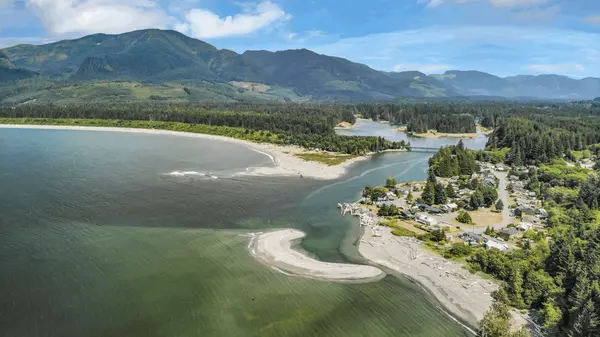
What People Actually Like About the North Island

Eleven Communities, Two Service Centres
The useful division here is not north and south. It is whether a community sits on the corridor or at the end of its own road.
On Highway 19
Sayward, Kelsey Bay, Woss, Nimpkish Heights, Hyde Creek, Port McNeill and Port Hardy. The drive to a larger centre is a straight run rather than a detour, and both of the region's hospitals are on this corridor.
At the end of their own road
Port Alice, Gold River, Tahsis and Zeballos. Each is reached by a separate route off the highway. That changes the drive to services, the winter picture and the cost of getting anything delivered.
The two service centres
Port Hardy and Port McNeill carry the groceries, pharmacies, banking and hardware for the north end, and both have a hospital. Almost every other community here measures itself against the drive to one of them.
Explore North Vancouver Island Real Estate
If you are considering a move, explore the local market, see homes currently for sale, or search every listing across North Vancouver Island on a map.
8 Questions for North Island Communities

Where Your Money Goes Furthest North of Campbell River

The Higher Priced Corners of the North Island


Moving North, and What Changes When You Do


Where the Two Hospitals Are
Island Health operates two hospitals in this region, at Port Hardy and Port McNeill, and both provide emergency care1. Anything more specialized generally means travelling south to North Island Hospital Campbell River and District, or further to Nanaimo or Victoria.
The smaller communities are served by health centres and clinics. Port Alice, Gold River, Tahsis, Zeballos and Sayward each have a local facility1, and what each one offers, and when it is staffed, is not the same. The question that matters is not whether there is a clinic. It is what happens at 2am, and how long that drive actually takes from the address.
What Distance Adds, and What It Buys
Housing costs less here than in most of the rest of Vancouver Island, and that number is real. For many buyers it is the difference between an attached home further south and a detached house on a lot, with a workshop, a garden or water access attached to it.
What the price does not include is what the distance adds. Fuel is the largest recurring cost for most households, because nothing is close and the distances have to be driven. Groceries and building materials carry the cost of being trucked the length of the Island. Trades and deliveries cost more and take longer to arrange, and on a rural property that is the normal way things work rather than an occasional inconvenience. The honest comparison is the purchase price set against those running costs, not the purchase price on its own.
When Highway 19 Closes
Highway 19 is the principal route through this region. When a section closes for weather, a slide or a collision, the detour options are limited and for several communities there is no practical alternative2.
It is something to plan around rather than worry about. Households here keep more in the cupboard, book appointments with room around them and check conditions before a long drive. Anyone who commutes, relies on freight arriving, or travels south for appointments on a fixed date should treat closures as a normal part of the year here, and understand that before buying rather than after.
A Resource and Marine Economy
Forestry, commercial fishing, aquaculture, marine work, tourism and the public sector carry most of the employment. Health care, education and local government provide the steadiest jobs in the larger communities.
That economy is a visible part of daily life here rather than a statistic. Working harbours, log sorts and fish boats are part of the character of these communities, and for a lot of residents that is part of the appeal. Remote work is viable where service is dependable, though connectivity is genuinely uneven across the region and should be verified at the specific address rather than assumed from a coverage map.
Storms, Outages and the Winter Version
Winter is the season that separates these communities from each other. Storms arrive off the open Pacific and the north coast, rainfall is high, and power interruptions on rural and corridor lines happen most years.
None of that is unusual to people who live here. Generators, backup heat and a stocked cupboard are ordinary equipment outside the larger centres, and the practical answer is preparedness rather than alarm. The seasonal change runs the other way as well. Fishing, tourism and marine traffic lift activity through the summer in the coastal communities, and the winter version of the same place is quieter, which is what a good many residents came for.
Getting Family Up Here
Port Hardy Airport carries the region's scheduled air service, and Port Hardy is a departure point for BC Ferries sailings to the Central Coast and Prince Rupert3. For most residents, though, the practical connection south is the drive.
It is long enough that visits get planned rather than happening on a whim, and people who make the trip tend to stay longer. An appointment in Nanaimo or Victoria is not a day trip. That is worth knowing if family is close and expected to visit often.
When You Stop Driving
This is the question worth answering before buying rather than after. Outside Port Hardy and Port McNeill, most communities here assume a vehicle for everything, including groceries and every medical appointment.
Transit exists in parts of the region and is limited compared with the south Island. For the communities at the end of their own roads there is no realistic version of daily life without driving, or without somebody driving for you. Port Hardy and Port McNeill generally offer more practical options than the smallest communities, so anyone planning past the point where driving gets harder should be weighing those two first.
What It Costs to Live Where Everything Is a Drive



What You Gain and Give Up on Housing
Housing choice here is different rather than simply narrower. It is overwhelmingly detached, on lots larger than anything comparable further south, and for a buyer who wants land, privacy, a shop or shoreline that is the point of being here.
The other side of it is the second move. Multi family and rental stock is concentrated in Port Hardy and Port McNeill, and purpose built seniors housing is limited across the region. When a house stops working and the community has nothing smaller in it, the choice narrows to moving to a larger centre or staying put in a home that no longer suits.
Neither fact cancels the other. A buyer here can gain space and afford a property type that is out of reach further south, and still have fewer options later. Anyone planning past the next decade should confirm what actually exists in the specific community rather than assuming something will appear.
Frequently Asked Questions About Living on North Vancouver Island
Why do people move to North Vancouver Island?
Mostly for space, privacy and access to the water and the back country, at prices below most of the rest of Vancouver Island. Detached housing on a real lot, a shop, a boat and a shoreline are within reach here for budgets that would not stretch to them further south. The trade is distance from services and a much smaller scale of community.
Is Campbell River part of North Vancouver Island?
Not in this guide. Campbell River is covered under Central Vancouver Island. North Vancouver Island here means the communities north and west of there.
How far is the nearest hospital on North Vancouver Island?
It depends entirely on the community. Port Hardy and Port McNeill each have one1. From Gold River, Tahsis, Zeballos or Port Alice the drive is substantially longer, because each sits at the end of its own road.
What happens when Highway 19 closes?
Alternatives are limited and for some communities there is no practical second route. Current conditions and closures are published by DriveBC2.
What is there to do outdoors on North Vancouver Island?
Fishing, boating, kayaking, diving, hiking and back country access all start close to home rather than at the end of a long drive. The inlets, the coast and the mountains are on the doorstep, and these communities are built around the water more than around a main street.
Are there smaller homes to downsize into?
Options are limited outside Port Hardy and Port McNeill. In several communities the housing stock is overwhelmingly detached houses on larger lots, so a later move to something smaller often means leaving the community.
Useful Resources for North Vancouver Island
- Island Health, North Island facilitiesHospitals at Port Hardy and Port McNeill, and the health centres at Port Alice, Gold River, Tahsis, Zeballos and Sayward.
- DriveBCHighway 19 conditions, closures and current travel information.
- Regional District of Mount WaddingtonLocal government for the north end, including the electoral areas and unincorporated communities.
- BC FerriesSailings from Port Hardy to the Central Coast and Prince Rupert.
Thinking of Moving North?
The north end trades service depth and proximity for space, affordability, privacy and unusually direct access to the ocean and the back country. Whether that works depends on which of those matter to you, and on which community you choose. If you are weighing two of them, or selling further south to buy here, I can walk you through what each one asks and what it gives back.